Wednesday, January 29, 2014

A Neat Bit Of Air Force History

I buy a lot of old Army manuals off of eBay.  I've found that purchasing these manuals on-line is a good, cheap way to build up a library of publications.  Plus, there's the thrill of the hunt!  I don't think I've paid more than $10 for a commonly available manual.  Most are well used, some downright raggedy.  A surprising number will contain an individual's name, unit and occasionally a service number.

One series of manuals I've focused on is the Army map reading manual series.  Starting about 1938 the Army realized it needed to develop the standardized procedures necessary to teach map reading and land navigation to millions of young draftees.  The Army introduced map reading manuals (FM 21-25 & 21-26) that received regular updates between 1938 and 1945.  I'll do a blog post on the evolution of map reading and land navigation during WWII at a later date.  Today want to focus on one specific manual that contains some interesting historical references.

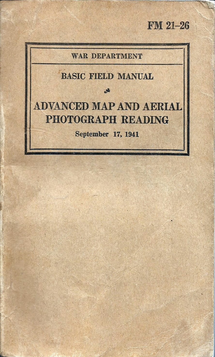
During WWII the Army split map reading and land navigation into two separate manuals - FM 21-25, Elementary Map and Aerial Photograph Reading and FM 21-26, Advanced Map and Aerial Photograph Reading.  FM 21-25 dealt mainly with the skills the common Soldier would need to master - map symbology, map orientation, interpreting contours, locating your position, basic map and compass work, etc.  FM 21-26 dealt with more complex topics, the sort of things NCOs and officers would apply, like advanced coordinate determination, time-distance calculations, determining intervisibility using contours and advanced aerial photo measurements and interpretation techniques.  It is common to find WWII-era copies of FM 21-26 with staff section - S2 or S3 - markings in them.  This was not a manual for the common Soldier.

The manual under discussion today was purchased off of eBay in 2013.  I bought it because it filled a hole in my collection.  September 1941 is, as far as I can tell, the first publication date for this manual.  The seller listed it as a run-of-the-mill manual, noting it's condition as good and containing the previous owner's information on the title page.  There was nothing unusual or unique about manual noted in the auction description.


The name was a little difficult to decipher, but I believe this is a George W. Havnar, Jr. who was born in 1918 and enlisted in the Army in January, 1941.  It's plausible that, in the fast expanding Army of 1941, he could have made the rank of Technical Sergeant after just one year of service.  

However, while flipping through the manual I came to the back pages and found something pretty interesting. Tech. Sgt. Havnar obviously used this manual as a travel log of sorts (click on any of the pages to enlarge):


The back pages are a listing of personnel names, units, locations, aircraft and operations that seem to trace the US Army Air Forces march across western Europe.  The chronology is hard to figure out, and it's clear a lot of this was written down long after WWII ended, but there's a lot of interesting history recorded in these pages.

Take for example this entry:


The Chuck Yeager?  I don't believe there was another Charles Yeager serving in the Army Air Forces in WWII, and since Chuck Yeager was a captain when WWII ended this inscription had to have been made post-WWII.

How about this entry:


There's two interesting names here.  First, Francis Gabreski was the top fighter ace in Europe during WWII. As good a pilot as Yeager was, 'Gabby' Gabreski was better, at least when it came to shooting down Germans. 


Next is Col. George Bickel.  The Warbird Information Exchange shows Lt. Col. George Bickel as Commanding Officer of the 354th Fighter Group:


Because of the disconnected nature of many of the entries, and the clear discrepancy between some of the personnel entries and their wartime ranks my suspicion is that Tech. Sgt. Havnar used this manual as a place to jot down references and remembrances of his service long after the war ended.  There's a date of 9/11/63 written on one of the pages, not connected to any other entry.  Perhaps he took the manual to a reunion in 1963 and sat around a table with some wartime buddies and just started jotting down notes as they swapped old war stories.  We'll probably never know, but it's certain that Sgt. Havnar had a keen interest and pride in his service and the Army Air Forces squadrons he served in.

Brian  


Saturday, January 25, 2014

Brunton Pocket Transit Brochure

Let's continue our conversation about the Brunton Pocket Transit.  In the past we've talked about how useful the pocket transit is, some of the different models available, and I've touched on some Brunton-related web resources.

So today let's take a look at a small brochure that William Ainsworth & Sons (the manufacturers of Brunton pocket transits for most of the 20th Century) used to make available to pocket transit customers.  This particular little booklet was published in 1929, but the illustrations look somewhat older than the late 20's, so I'm guessing this is a reprint of an earlier brochure.  The brochure is small - just a bit larger than a 3" x 5" index card and it's only 21 pages.


It's an extremely useful little book, because it covers in some detail the different ways you can use the pocket transit, whether it's shooting azimuths, reading horizontal or vertical angles, tracing a mineral vein or using the instrument as a clinometer or a plumb.


There's even instruction on how to use the pocket transit in conjunction with the 'Wilson Magnetometer Attachment', a real Rube Goldberg device that is intended to be mounted to a plane table to measure large anomalies in magnetic intensity found in mineral bearing rock formations.  I've never seen a Wilson Magnetometer in person, but I'm keeping my eye out for one!


There's a lot of useful info stuffed into these 21 pages and I thought it important to make the booklet available to the collector community.  You can click here to download the pamphlet as a PDF file (about 1.6 mb).  You can also access the individual pages as images by clicking here to access my Picasa site.

So you Brunton fans out there, enjoy!

Update!  Just today I was doing a Google search on a topic related to Brunton pocket transits and I ran across an interesting booklet titled "Enterprise & Innovation In The Pikes Peak Region" published in 2011 by the Pikes Peak Library District.  In the booklet is a very informative article about David W. Brunton, the inventor of the Brunton Pocket Transit.  There's a very good discussion about the development of the pocket transit.

Brian


Sunday, January 19, 2014

Mea Culpa

The Apple iPad.  It created an entire market.  Before the iPad there was nothing.  After the iPad there was true mobile computing, the freedom of the always on, always available device, the one-swipe window to the world wide web.  Apple's mobile operating system, iOS, and the concept of 'the app' redefined functionality on computing devices - small, focused applications highly optimized to a tightly integrated hardware and operating system platform, a platform that brooked no abnormal behavior and assured a commonality of user experience across the software application spectrum. It didn't matter if you were running Angry Birds or a medical diagnosis tool, the touches, taps, swipes and pinches accomplished the same basic end in all apps. That was the genius of the iPad - an extraordinarily high degree of consumer satisfaction via the enforcement of rigid standards.  It's amazing that a borderline anarchist like Steve Jobs was able to convince legions of slavish fans and, more surprisingly, customers in whole new market segments, that the way to 'be a rebel' was to develop for, buy and use some of the most restrictive hardware and software ever brought to market.


Amazing indeed, and it worked!  The iPad and other iOS devices (iPhones, iPod Touches) have revolutionized how many companies operate and opened up new markets and business opportunities, some of which simply didn't exist before the iPad arrived.  So it is with GIS.  Steve Jobs and Apple didn't intentionally set out to create a geospatial hardware platform that is having a huge impact on my industry, they just created the development opportunity that permitted others such as ESRI to see the potential of the device and develop software to exploit that potential.  Beginning several years ago ESRI developed and steadily improved a small collection of applications that leveraged GIS data and services residing in their proprietary 'cloud'.

Over the past few years whenever anyone in my organization came to us and asked what tablet they should buy for mobile GIS our reflexive answer was (and still is), "get an iPad".  The choice made perfect sense.  While ESRI also develops apps for other mobile operating systems - Android, Windows Phone, even Blackberry and the old Windows Mobile (aka, Windows CE) - ESRI today first develops against Apple's iOS.  The reasoning is simple - iOS has been stable for a long time and with it's tight ties to a relatively small selection of Apple-only hardware it is fast and easy to build stable, well functioning apps.  No so with the other operating systems, which seem to change almost weekly and are deployed on a bewildering array of hardware platforms.

(Some time ago I queried one of ESRI's developers about why they focus first on iOS and his comment was classic, "Brian you have to understand, iOS has been stable for about two years.   Android's been stable for about two weeks.")

But what about the other players in the same market segment, particularly Android?  When we first started testing GIS apps on tablets at TATSNBN (The Airport That Shall Not Be Named) we wanted to be as hardware and operating system agnostic as possible.  We really didn't know what our IT department was thinking about selecting for use across the airport.  One week the rumor was Apple, then the smart money shifted to Galaxy Tabs, then it was (just shoot me now) HP tablets running their mobile OS, then later the meme shifted to the new Microsoft Surface running Windows RT.

Early on I managed to get my hands on a Samsung Galaxy Player 5 running Android 2.3.  The hardware was actually pretty good - a 5" mini-tablet that seemed to offer a lot of potential.  The Player 5 was Samsung's answer to the Apple iPod Touch and it came in at about half the price.  I really liked it.  Too bad Android sucked.

YP-G70CWY/XAA
Samsung Galaxy Player 5
Sadly it's no longer in Samsung's lineup

By this time I had a lot of experience with the iPad and iOS.  I was using my personal iPad at work to test these GIS apps and my family members were heavy users of both iPads and iPhones.  I had a deep understanding of iOS and the user experience it delivered.  By comparison Android 2.3 was a kludge.  Now, Android 2.3 wasn't a bad OS. Far from it.  I had a number of coworkers who were perfectly happy with their Android smart phones and tablets.  If iOS had never been developed I'd have been singing the praises of Android 2.3 with an exalted voice.  But iOS did exist, and by comparison Android 2.3 sucked. It was complex, counter-intuitive and difficult to learn and manage. It's easy to see why Apple swept all before it.

Eventually a limited number of airport-owned iPads made it into the hands of employees in our business units, and life was good.  We only had to worry about supporting one platform.  But then something happened.  Android came a-calling once again.  As word got out about the usefulness of our mobile GIS services an increasing number of employees at began asking if we could recommend a specific Android device that they might buy themselves for use at work. We tried to steer them towards iPads but many balked at the premium prices Apple demands for their products.  They wanted to test a cheaper Android-based alternative.

My old observations about Android 2.3 resurfaced and I felt uneasy recommending any Android tablet. However, in the intervening two years Google had become more aggressive with Android and had even introduced their own line of mobile devices.  The specs on the Google Nexus 7 tablet released in 2013 looked particularly good. GPS/GLONASS, 5mp camera, digital compass, accelerometer, wi-fi, long battery life and a high resolution screen indicated that it would make a pretty good mobile GIS unit. Another bonus is that it was priced at less than half the cost of an equivalent iPad Mini.  But it was still an Android device.  The Nexus 7 tablet was running Android 4.3 (later updated to Android 4.4), the most current version of the OS.  Reviews on the web gave it high marks, but most of the reviewers were long established Android fanboys so I had to take their observations with a grain of salt.  Still, the capabilities vs. price comparison was compelling and many of the reviewers had a good point in that the Nexus line of tablets are Google's own flagship devices and therefore will always be running the most up-to-date and stable version of Android.  I decided to give the Nexus 7 a try.

Well, four months into the evaluation I'm here to tell you that not only is the Nexus 7 running Android 4.4 good, in many ways it's better than the iPad!  So good in fact that I recommend it over iOS devices to people with no other ties to the Apple ecosystem (for example, folks who don't already have an iPhone or iPod and who might like to take advantage of cross-device syncing).


What makes it so good?  It comes down to the old car salesman's pitch: price, performance and features.

  • Price - we've already covered this one.  The Nexus 7 comes in at about half the price of a comparable iPad. 
  • Performance - fully as good as any of the iPad's I've used.  There may be differences in processor speeds, camera features, touch screen responsiveness, battery life, etc. but in the world of real use testing I see no difference between the Nexus and the iPad.
  • Features - when you match the Nexus and iPad up feature for feature you realize that the Nexus matches the iPad in most areas and even beats it in a few others. The best example is GPS.  The Nexus 7 comes standard with integrated GPS/GLONASS.  If you want this same feature on an iPad you have to pay an additional $100 because only the more expensive data plan-ready iPads have integrated GPS.  This is my biggest complaint about the iPad because it makes the basic (non-GPS) units all but useless as geospatial data collectors.  Apple sees GPS integration as a 'premium' feature while the rest of the mobile world sees it for what it is - a commodity feature.

With Nexus 7 you get GPS.
Can't always say that about the iPad!

I do have to give the nod to the iPad in a few areas.  First is build quality.  Apple's build quality is always top-tier, and the build quality differences between the iPad and the Nexus 7 are obvious.  The Nexus is manufactured by ASUS and it feels exactly like what it is - a plastic bodied tablet.  While the ASUS build quality is very good it in no way matches the solid industry leading build quality and feel the iPads are known for.   But consider this - if I drop my iPad mini and break it I'll stand there and cry, bemoaning the loss of my $530 jewel.  If I drop and break my Nexus 7 I'll just go order a new one.


The Nexus 7 makes a pretty good Collector for ArcGIS platform

Next is screen resolution.  OK, the Nexus is no slouch.  In fact it's pretty darned good - real good considering the price of the unit.  Google put a lot of time and effort into getting the screen right, and it shows.  But Apple's current Retina display is the industry leader for a reason. It can't be beat in terms of resolution, clarity, color fidelity and brightness.  Do you give anything up by going with the Nexus?  No, not in real use terms, but Apple has the clear lead here. The screen is just better.

But at the end of the day do these differences matter?  No, not really.  Because here's the real deal maker - the current version of Android, version 4.4, is damned good. From a user experience perspective it has moved way beyond the clunky fanboy experience that was Android 2.3.  I'll anger the legions of Apple fans in my family and state that Android 4.4 is as good as iOS 7.x.

After my Android 2.3 experience I was expecting to have to deal with an immature, techie focused operating system.  I was impressed to find instead a stable, mature, feature rich operating system that makes this a serious business tool.  A large part of the improvement is Android 4.4's tight integration with Google's cloud computing environment, including Google Drive, GMail and Google Docs.  In my opinion Google just has a far better implementation of these services and features than Apple does with its comparable products such as the iWorks suite.

Is the Nexus 7 a perfect device?  No, of course not.  It won't fit everyone's needs, but I do recommend you give it a hard look before making what would otherwise be a reflexive Apple purchase.

Brian


Wednesday, January 1, 2014

Orientation - It's Not Just For College Freshmen!

I came across another neat little Army publication the other day, one I'd never heard of before and initially thought it was an Army Corps of Engineers manual:


This little manual covers a lot of advanced topics such as geodesy, survey, coordinate determination, even astronomical observations using theodolites.  It's a  pretty intensive manual, chock full of weighty Engineer topics.

Only it's not an Engineer manual.  I was surprised and bemused to see that it was published in 1941 under the direction of the Chief of Coast Artillery.  Huh?  Coast Artillery?


So what did the Coast Artillery mean when they used the term 'orientation'?
Definition - The term orientation as used in the Coast Artillery Corps means:
a. The accurate location of datum points and the establishment of ines of known length and direction.
b. The adjustment of the azimuth indicating devices on guns and observing instruments when the axis of the line of sigh is pointed at that azimuth.

Application - In its application to artillery, the term orientation includes the following:
a. The determination of the meridian for the measurement of azimuths.
b. The determination of the coordinates of the directing point, observing stations and spotting stations for a battery.
c. The determination of the length and azimuth of base lines and director offsets.
d. The establishment of such reference and datum points as may be necessary.
     
(TM 4-225 Orientation, paragraph 2. a. & b.)

For those not aware, since the founding of our country right up until the mid-20th Century our key harbors and coastline sections have been overwatched by large artillery pieces, designed and situated to destroy enemy vessels intent on entering our harbors and waterways and doing damage.  In fact, one of the earliest jobs of the Corps of Engineers was the construction of harbor and waterway defenses and the siting and preparation of the firing positions for these coastal artillery guns.  However, it wasn't until 1901 that the Army recognized the key differences between the missions of the coast artillery and field artillery by establishing the Coast Artillery Corps as a separate branch.

Modern field artillery has always had a strong need for surveyors.  As the concepts of indirect artillery fire matured and rifled cannon delivered the ability to fire projectiles far beyond the visual range of the gun crews the need for surveyors to accompany and support field artillery units emerged.  After all, to accurately hit a target you can't see you first have to know precisely where you are.  Many of the concepts covered in this little manual are directly applicable to field artillery survey.  But we are talking about field artillery -  guns that get towed around the battlefield by trucks, set up, shoot some shells then pack up and move to the next firing position.  Coast Artillery is a different beast.  It operated large, permanently placed guns overlooking harbors and waterways that were already precisely mapped.  Why the need for more advanced surveying and mapping techniques?  The answer is laid out in Section (Chapter) IX of the manual, where it discusses the duties of the Battalion Reconnaissance Officer.


It appears that not all Coast Artillery cannon were permanently mounted.  At the time of publication the Coast Artillery Branch either had or was anticipating use of mobile 155-mm artillery, railway artillery and anti-aircraft guns.  It would be the responsibility of the Reconnaissance Officer and his reconnaissance parties to find new gun locations, work out their proper positioning (orientation) and if necessary map the the new areas of coverage so the gunners knew where they were shooting.

The battery reconnaissance officers, under the supervision of their battery commanders, compute the data necessary for the orientation of the plotting boards and complete the organization of the battery plotting rooms and observing stations.  The battery executives, utilizing the orienting lines supplied them, orient the guns of their batteries.
          (TM 4-225, paragraph 49. e.)

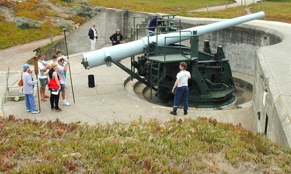
While coastal defense was a huge mission during WWII, and the Coast Artillery branch provided a key service to the nation, it quickly became apparent that aircraft were a far more effective coastal defense tool than land-based artillery.  By the end of the war long range bombers and radar made fixed coastal defense sites obsolete. In 1950 the US Army dissolved the Coast Artillery branch and absorbed its officers and enlisted personnel into the regular Field Artillery branch. Today all that remains of a once proud branch of the US Army are some abandoned casements dotted along the Atlantic and Pacific coasts, and at the Presidio of San Francisco you can still view an original 'disappearing' coastal defense gun at Battery Chamberlin.


Battery Chamberlin
The Presidio of San Francisco

Brian